For administrative purpose the district has been divided into 1 sub-division and 10 Blocks as follows:- Dumka, Gopikandar, Jama, Jarmundi, Kathikund, Masaliya, Ramgarh, Ranishwar, Saraiyahat and Shikaripara and fifteen PS/OP namely Dumka, Muffasil, Gopikandar, Jama, Jarmundi, Taljhari, Kathikund, Masalia, Ramgarh, Raneshwar, Shikaripara, Saraiyahat, Tongra, Hansdiha and Massanjore.
History
The district is perhaps one among the earliest ones to play a leading role in the freedom movement. Dating back to the year of 1785 and running down to 1855 or to 1942, huge sentiments are attached that can surely mesmerize the patriotic fervor of anyone. The district played a crucial role in the Santhal uprising against the British Government which led to the enactment of Santhal Pargana Tenancy Act.
Geography
The district is drained by the Brahmani, the Bansloi, the Mayurakshi, and their numerous tributaries. These streams are ephemeral in nature. Most of these stream courses are structurally controlled. The district is divided with rivers of varying magnitude. Mor with its tributaries carry the drainage to the western part of the district which finally meets the Bhagirathi river below Murshidabad, West Bengal. The Brahmani rises in the west of the Dudhua hills in the north of the Dumka district. Dendritic drainage pattern, a typical feature of hard rock terrain, has developed over the district. However, radial drainage is also developed locally in some areas. All these drainage areas are having rapid surface runoff. Surface flow of most of the rivers dries up during summer, however there is subsurface flow for a considerable part of the year, which indicates the effluent nature of the rivers.
 Mayurakshi River, Dumka
 ADB roadside plantation, Dumka
Forests
Dumka is part of the “Damin e-Koh” forest series that starts from Sahibganj, continuing through Godda and Pakur divisions and ending in Dumka. Forests of the division are spread over the northern part of the Santhal Pargana plateau and forests lie mainly on its undulating slopes. The topography is hilly with occasional tracts of flat plateau and valleys. The terrain is extremely varied and is spotted with several prominent hills. Dumka is situated in an idyllic surrounding of hill ranges, rivers and forests. The District of Dumka is an upland tract with a hilly backbone running from North to South. Ramgarh Hills lies in the South East of Dumka, Lagwa Hills near Nonihat, adds a fascinating charm to the beauty of the District and gives satisfaction of rare scenic beauty to those who toil hard to scale the heights of the mountain ranges.
Forest cover of Dumka is around 15% of the total geographic area of the district. Sal trees dominate the natural forest along with a good presence of Mahua, Palash, Khajur and other species, while Kathikund has significant area under bamboo forests.
Fauna in Dumka Forest Division includes -mammals like jackals, wild hare, Nilgai etc and many species of birds and reptiles. Dumka division also falls in the traditional migration path of elephants and winter birds.
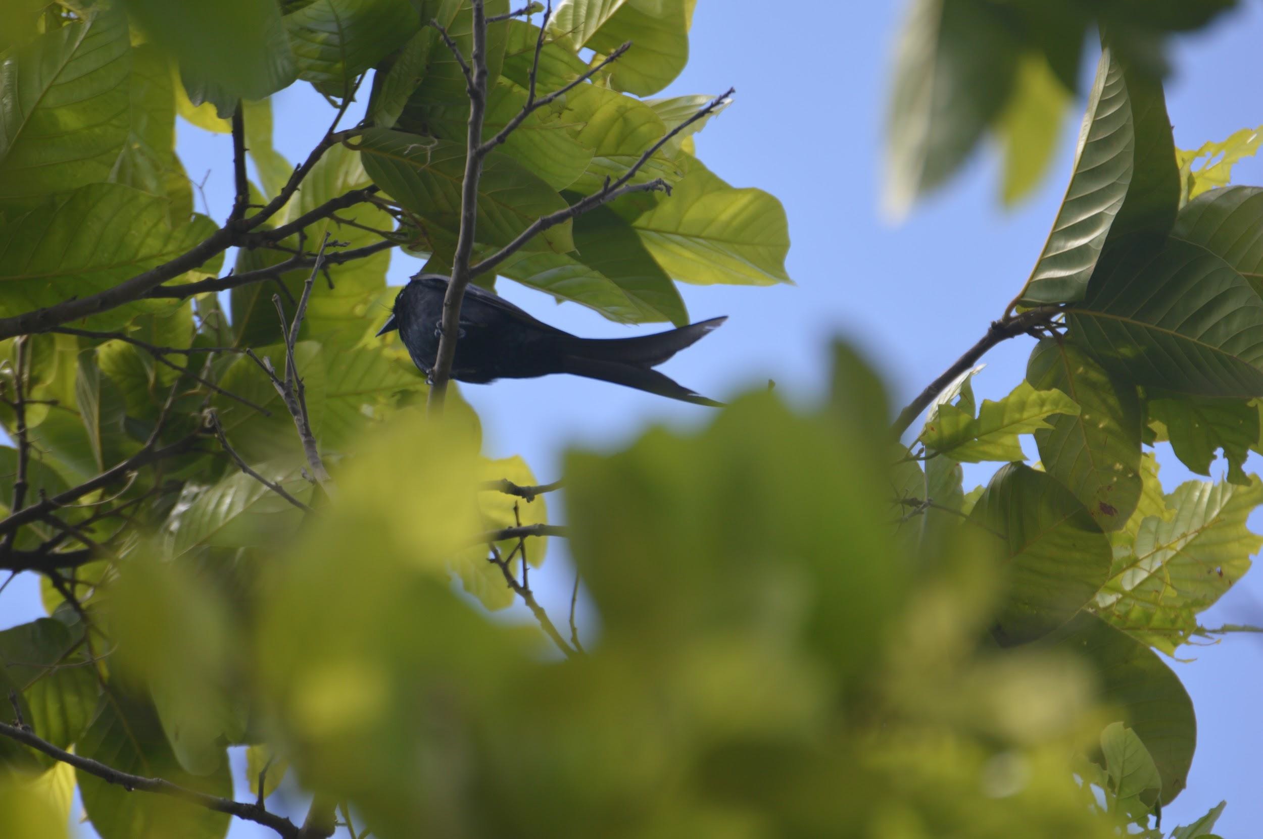 Black Drongo (Dumka)
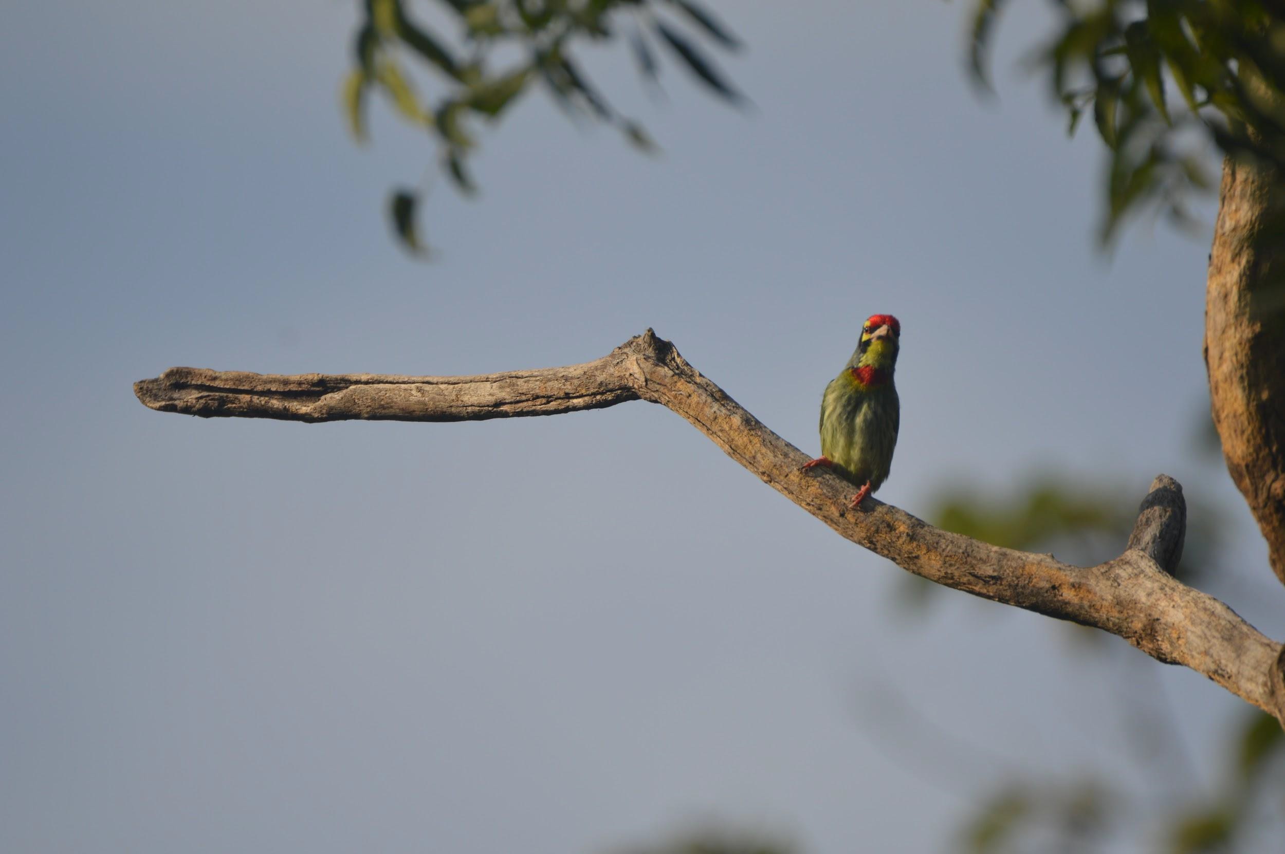 Coppersmith Barbet (Dumka)
 Migratory elephant herd in Sal Forest (Ranishwar, Dumka)
Climate
The Climate of Dumka division represents a transition between the dry and extreme climate of northern India and the warm and humid climate of West Bengal. The area has three distinct seasons of the monsoon type of climate- the summer, the rainy and the winter seasons.
Being situated just beyond the tropic of cancer and away from the sea the winter is quite distinct and prominent. It commences from mid November and extends up to the middle of March, December and January being the coldest months. It is characterized by heavy dew, thick fog and associated with cold waves. There is a small winter rain during January and February. The winter is generally pleasant except for a short span when the night temperature almost touches the freezing point. Frost is not very common but certain low lying pockets on the plateau near depressions and along the nalas become frosty during the cold wave.
The winter is followed by summer which lasts till mid – June and then monsoon sets in which generally lasts till the end of September. During winter the mercury drops to 4 degree Celsius and during summer it shoots up to 46C. The relative humidity varies between 50 – 60%.
 Natural spring water in Shikaripara, Dumka
Due to comparatively higher altitude, the extreme temperature during summer is ameliorated. However, places at lower altitudes record quite high temperatures during summer which adversely affects the plantations. Hot westerly wind, the ‘LOO’ is experienced all over the division during the months of mid April to June.
Monsoon generally breaks by the end of June and continues till the end of September.
Pre-monsoon showers during late May or early June are common features. The rainy season ends with the Hathia rain in early October.
Demographics
As per 2011 India census, Dumka is a Nagar Parishad city in district of Dumka, Jharkhand. The Dumka city is divided into 21 wards for which elections are held every five years. The Dumka Nagar Parishad has a population of 47,584 of which 25,364 are males while 22,220 are females as per report released by Census India 2011.
Population of children with the age of 0-6 is 5371 which is 11.29% of the total population of Dumka (Nagar Parishad). In Dumka Nagar Parishad, Female Sex Ratio is 876 against the state average of 948. Moreover, the Child Sex Ratio in Dumka is around 891 compared to Jharkhand state average of 948. Literacy rate of Dumka city is 89.92% higher than the state average of
66.41%. In Dumka, Male literacy is around 93.46% while female literacy rate is 85.87%.
Places of Tourism
This district is very important from the religious point of view. People from different states visit the religious, historical and archaeological places of this district. Baba Basukinath Temple, Maluti Temple etc. find mention in the diaries of all the traditional devotees.
Massanjore Dam on Mayurakshi river and the backwaters of Dam at Baskichak are another big attraction for tourists.
Dumka Forest Division maintains 4 guest houses at- Dumka, Basukinath, Kathikund and Digalpahari. Dumka Forest Division is also involved in promoting eco-tourism activities at Massanjore and via creation of biodiversity park in Banderjodi village.
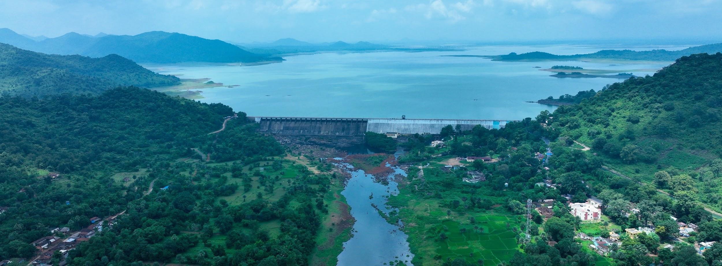 Massanjore Dam, Dumka
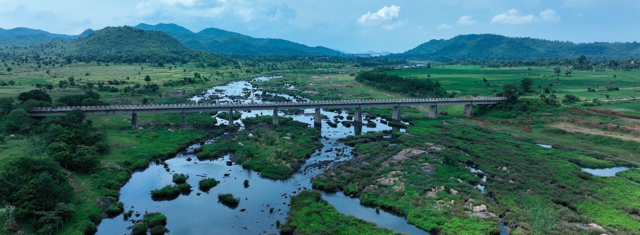 Mayurakshi River downstream of Massanjore Dam
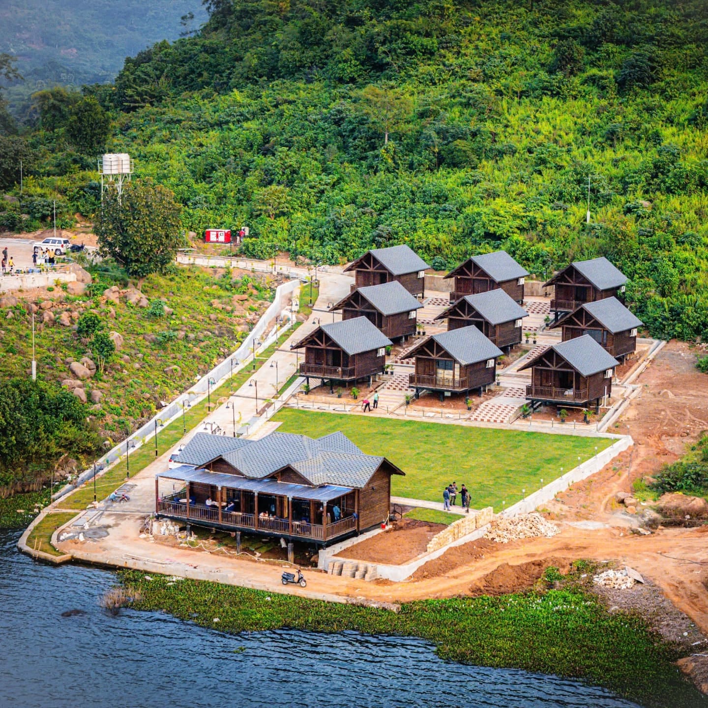
Massanjore Eco-resorts
Nestled on the banks of the majestic Massanjore Dam, our eco-resort features 25 elegantly crafted cottages, including 10 premium and 15 deluxe options, made from sustainable SPF wood. The resort boasts a picturesque cafeteria overlooking the dam, as well as a range of modern amenities, including a spacious parking area, fully equipped gym, and thrilling speed boat rides. With a total project cost of approximately ₹7 crores, this eco-resort offers a unique blend of natural beauty and luxury.
For Booking of Ecotourism Resort Contact : +91 8252893391
 Massanjore Eco-resorts, Dumka
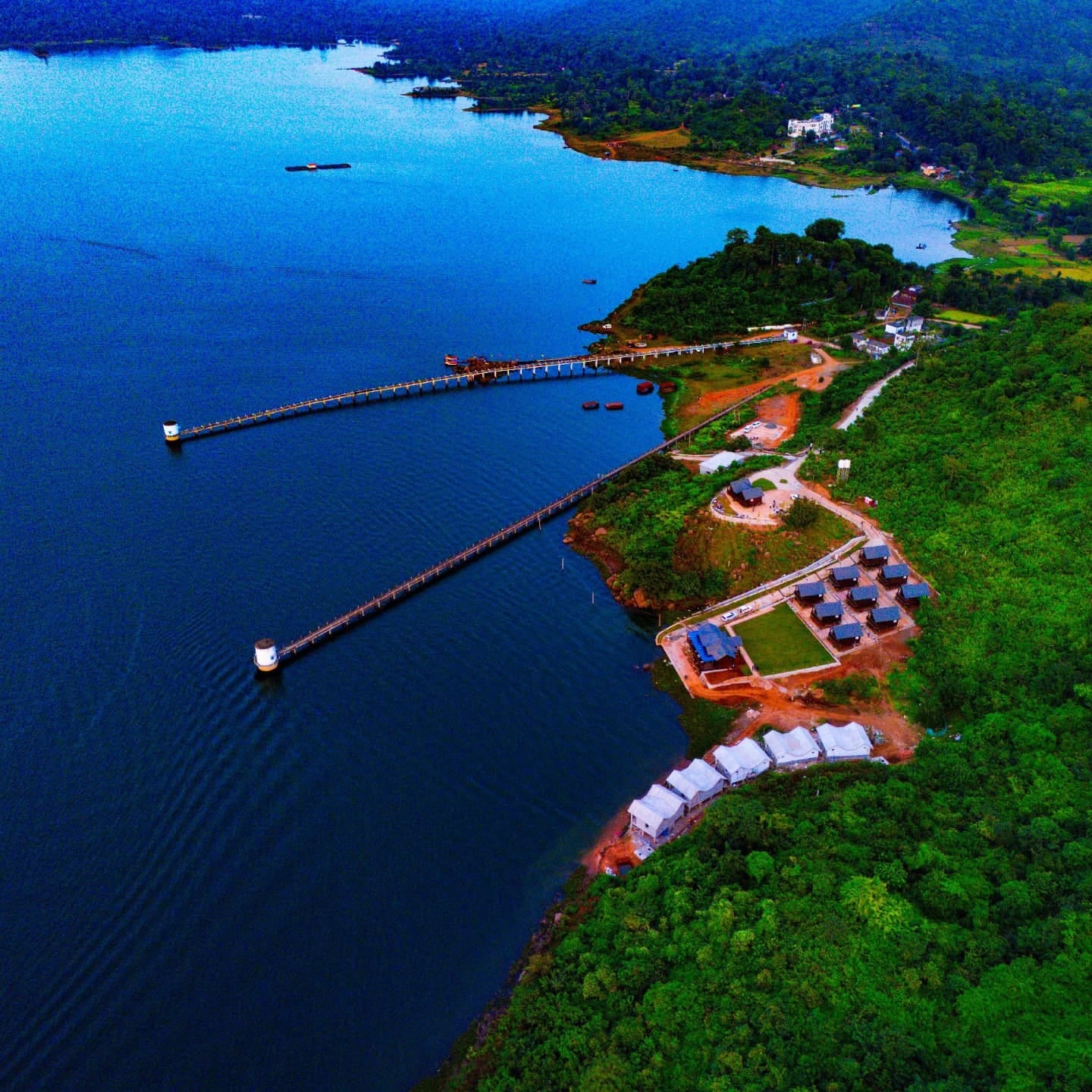 Massanjore Eco-resorts, Dumka
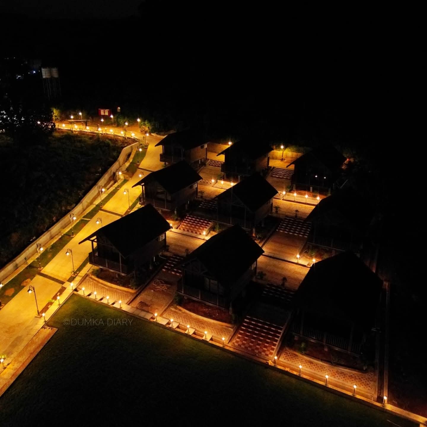 Massanjore Eco-resorts, Dumka
 Massanjore Eco-resorts, Dumka
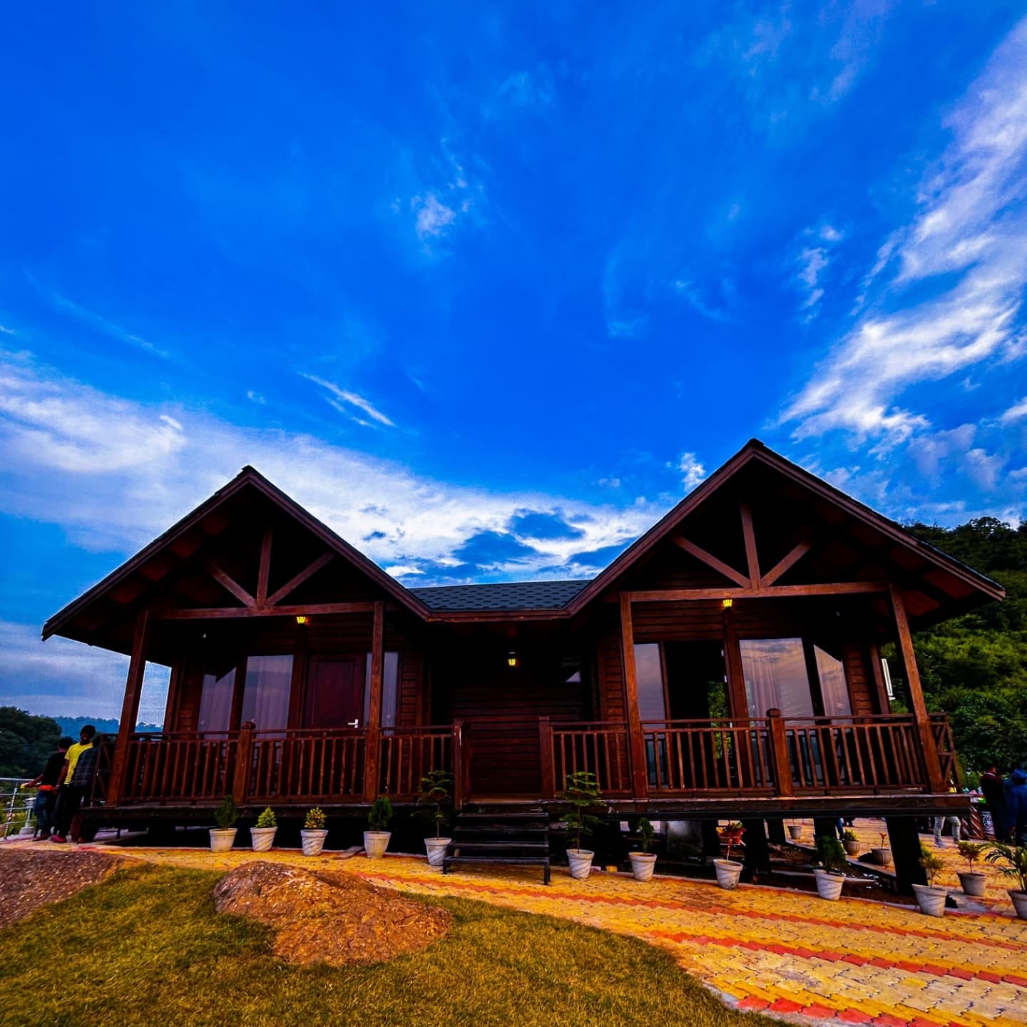 Massanjore Eco-resorts, Dumka
Forest Based Livelihood
Due to the good presence of Sal trees, Dumka Forest Division along with District administration started a program where self help groups of women were given the training and facility of making Sal leaf plate, popularly known as “dona”. Collection of fallen sal leaves has thus emerged as a major source of extra income to these households.
Multi food processing machine has been set up in Ranishwar to process forest products like Khajur Gud and Mahua Ladoo. Other forest dependent livelihood activities include collection of Tendu leaves, lac cultivation, wild honey collection and handicrafts made from Bamboo.
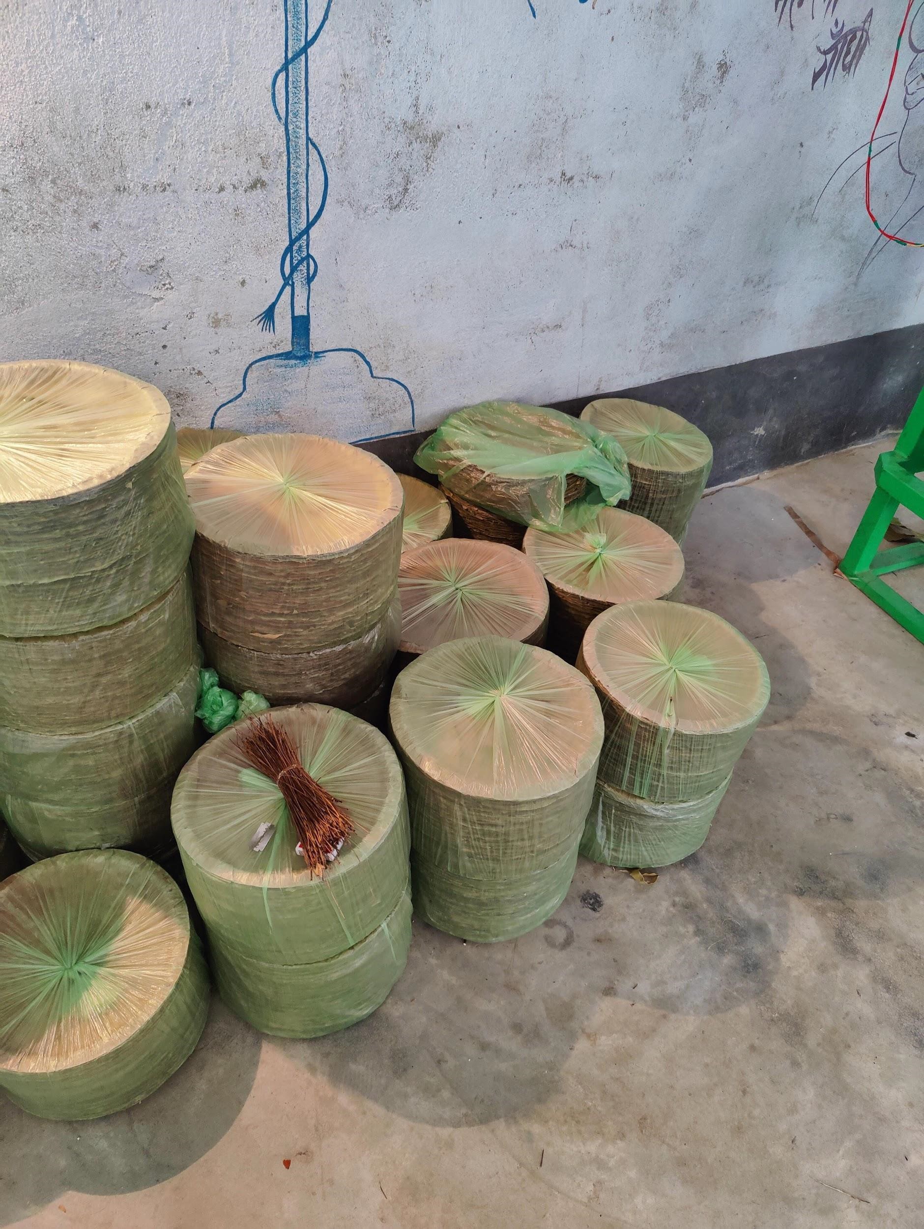 Sal leaf plates Unit, Masalia (Dumka)
| Range, Beat and Sub-Beat of Dumka Division |
| Range Name |
Beat Name |
S.No. |
Sub-Beat Name |
| Hizla East |
Asanbani |
1 |
Asanbani |
| 2 |
Dhanbasa |
| 3 |
Dhanbasa |
| 4 |
Gando |
| Rani Bahal |
1 |
Amjora |
| 2 |
Bagnal |
| 3 |
Banskuli |
| 4 |
Kumirdaha |
| 5 |
Rani Bahal |
| Shikari Para |
1 |
Banspahari |
| 2 |
Rajbandh |
| 3 |
Shikari Para |
| 4 |
Simanior |
| Hizla West |
Basukinath |
1 |
Basukinath |
| 2 |
Belkupi |
| 3 |
Jardaha |
| 4 |
Kesri |
| Khasmahal |
1 |
Asna |
| 2 |
Khasmahal |
| 3 |
Khejuria |
| 4 |
Majhiyara |
| Masalia |
1 |
Choto |
| 2 |
Gormala |
| 3 |
Gumro |
| 4 |
Lakhanpur |
| 5 |
Ranga Masalia |
| 6 |
Sapchala |
| 7 |
Singro |
| 8 |
Tasariya |
| Nonihat |
1 |
Amarpur |
| 2 |
Amdiha |
| 3 |
Dighi |
| 4 |
Nonihat |
| 5 |
Saraiyahat |
| Kathikund |
Chirudih |
1 |
Chirudih |
| 2 |
Durgapur East |
| 3 |
Durgapur West |
| 4 |
Silangi |
| Gopikandar |
1 |
Gopikandar East |
| 2 |
Gopikandar West |
| 3 |
Karudih |
| 4 |
Korcho |
| Kathikund |
1 |
Jhilimili |
| 2 |
Kathikund East |
| 3 |
Kathikund West |
| 4 |
Masnia |
| 5 |
Saldaha |
| Narganj |
1 |
Baskia |
| 2 |
Bora Pahari |
| 3 |
Lakhanpur |
| 4 |
Narganj |