In terms of vegetation, Giridih District exhibits a mix of forests and agricultural lands. The forests are mainly composed of deciduous trees like sal, mahua, and bamboo. These forests not only serve as a habitat for wildlife but also contribute to the ecological balance of the region.
Giridih East Forest Division in its abode provides many picturesque destination, offering a blend of natural beauty and cultural heritage. The town is known for its enchanting hills, dense forests, and cascading waterfalls. Parasnath Hill, the highest peak in Jharkhand, is a significant pilgrimage site for Jains. It attracts pilgrims and tourists from far and wide. Although part of Wildlife sanctuary now, the madhuban forest provide continuity and connectedness to the same The Usri Falls and Khandoli Dam attract nature enthusiasts with their serene surroundings and opportunities for outdoor activities. The ancient Jain temples of Jharkhand, such as the Jharkhand Siddha Kshetra and Madhuban, showcase architectural brilliance and spiritual significance. Giridih offers a tranquil escape from the bustling city life, allowing visitors to rejuvenate amidst nature's splendor.
As per working plan 2011-12 to 2022-23, the Range wise area is as below: -
|
Sl no.
|
Name of Range
|
Reserve Forest (RF)
(in Ha.)
|
Protected Forest (PF)
(in Ha.)
|
Un-demarcated Forest (UD)
(in Ha.)
|
Demarcated but not notified (UN)
(in Ha.)
|
Total (in Ha.)
|
|
1
|
Giridih
|
485.27
|
19638.99
|
2209.44
|
416.52
|
22750.22
|
|
2
|
Gawan
|
0.00
|
48924.65
|
6846.49
|
1440.25
|
57211.39
|
|
3
|
Dumri
|
0.00
|
11759.95
|
935.87
|
1213.20
|
13909.02
|
|
4
|
Khurchutta
|
4293.14
|
12691.52
|
3397.57
|
754.08
|
21136.31
|
|
5
|
Parasnath
|
0.00
|
5261.41
|
1291.65
|
482.53
|
7035.59
|
|
|
Total
|
4778.41
|
98276.52
|
14681.02
|
4306.58
|
122042.53
|
The terrain is extremely varied and is spotted with several prominent hills. The district is a part of the North Chhotanagpur Division and there are two distinct divisions of this district - Central Plateau and lower plateau. The central plateau touches the western portion of the district near Bagodar block. Around the central plateau are the lower plateaus on all sides except the western portion on which side a ridge connects the central plateau to the Palamu district. The lower plateaus average 1300 feet in height, their surface being undulating, in the north and north-west, the lower plateaus form fairly leveled tablelands until they reach the ghats when they drop to about 700 feet. In the east, the general elevation is lower and the descent gradual. The famous Parasnath Hill is located in this division, which has the distinction of having the highest peak in the state, with an altitude of 4431 feet above the mean sea level.
The land of the district is rocky and in some parts it is cultivable. Dumri, Pirtand, Gandey, part of Giridih, Tisri, Gawan and part of Deori are hill areas, where as Jamua, Dhanwar, Bagodar and Bengabad Blocks have cultivable areas.
Giridih District is drained by several rivers and streams. The Barakar River flows through the western part of the district, while the Usri River and its tributaries traverse the central and eastern regions. These rivers not only enhance the natural beauty but also contribute to the agricultural productivity of the area.
The climate of Giridih is characterized as tropical, with hot summers and relatively cool winters. The monsoon season, from June to September, brings moderate to heavy rainfall to the region, nourishing the agricultural lands and enhancing the greenery.
The area has typical three distinct seasons, the summer, the rainy and the winter seasons of the monsoon type of climate. Hot weather is experienced all over the track during the months of mid April to June when the maximum temperature touches to 44-46 degree Celsius on few days. Pre-monsoon showers during late May or early June are common features. The winter is generally pleasant except for few days when the night temperature almost touches the freezing point.
Tourist Attractions
Famous Tourist destination of the division include the following:
- The enchanting hills, dense forests, and cascading waterfalls of Parasnath Hill, the highest peak in Jharkhand, is a significant pilgrimage site for Jains.
- Madhuban forest of Giridih East Forest Division provide continuity and connectedness to the same.
- Usri Falls and Khandoli Dam provides opportunities for outdoor activities.
Forest Rest House Details
- Accommodation facilities – Bengabad Rest House-2 Rooms, Tisri Rest House-4 Rooms, Gawan Rest House -2 Rooms
- Type of Rest Houses - Pakka Construction
- Location- Bengabad (Khurchutta Range), Tisri & Gawan (Gawan Range)
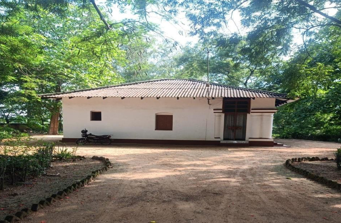 Bengabad Rest House
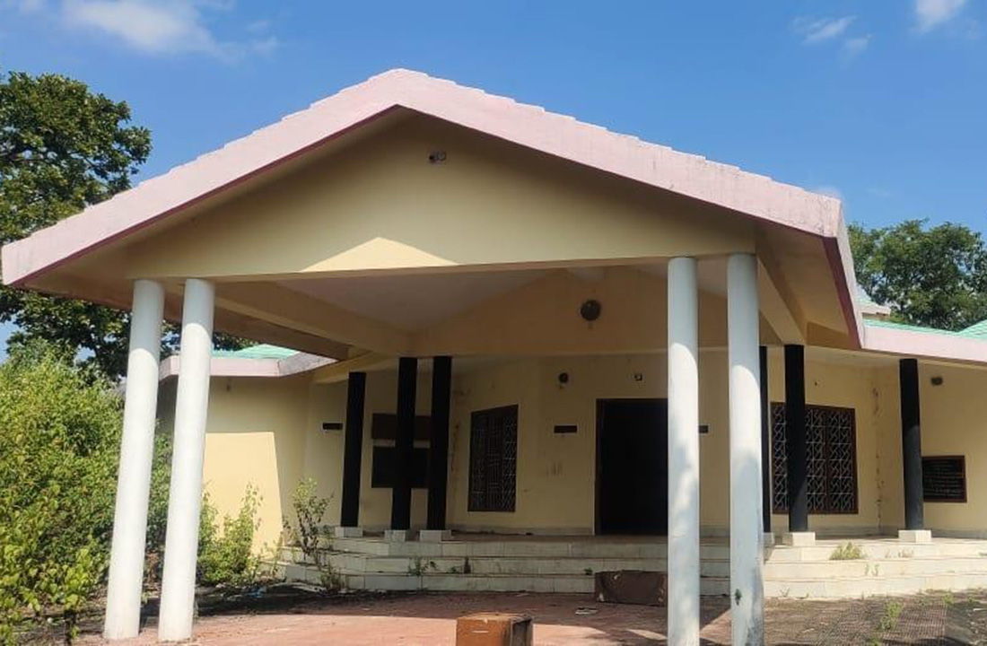 Tisri Rest House
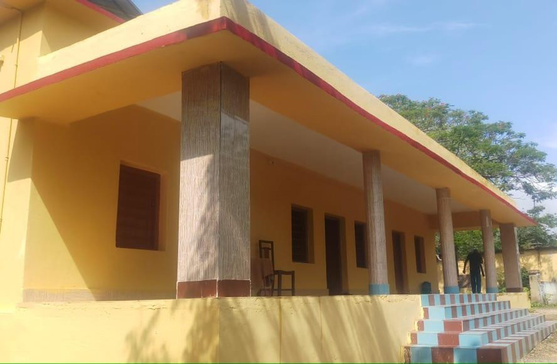 Gawan Rest House
How to reach
There are regular bus services and private Taxi is also available from Giridih city to all tourist place.
By Road : There are regular bus services from the Giridih city to Bengabad, Tisri and Gawan.
Rail
Giridih railway station
Giridih railway station (GRD) is connected to Madhupur Junction (MDP) located 38 km to the east by a single broad gauge railway line. There is a single passenger train which runs five times a day between the two stations and takes about an hour to reach Giridih. Giridih is under the administration of the Asansol division of the Eastern Railway zone of Indian Railways.